Plantation, FL Hail Storm – November 2026
November 17, 2026 hail storm near Plantation, FL. Radar-confirmed hail track and contractor lead lists available.
Max Hail
1.85"1.25" est.
confirmed
Zones
3
NWS alerts
Radar
66
dual-pol hits
Spotter
3
field reports
NWS WARNING AREA · Plantation Metro · Nov 18, 2026
Intelligence Platform
StormSnipe Pro
$49/ mo
Cancel anytime · No contracts
›All 50 states
›No zone limits
›No per-event fees
Subscribe to Pro
Pro renews monthly until canceled · Cancel anytime in the billing portal
What's included
Instant delivery
Every storm published within hours of NOAA confirmation.
Interactive Strike Map
Full radar-confirmed hail track on an interactive map.
Address CSV export
Every affected residential address, export-ready.
Smart alerts
Notified when a storm hits your area. Set zones once.
Nationwide coverage
All 50 states. No zone restrictions. No geographic caps.
Live pipeline
NOAA NEXRAD processed and delivered 24/7.
Address data notice
Pro coverage in California, Vermont, and Oregon includes the confirmed hail track and Strike Map only — no address lists. State data-privacy law treats compiled address lists differently in those three states, so we exclude their addresses from extraction and delivery.
NWS WARNING AREAS · 3
This storm generated 3 NWS alert zones. Pro access covers the complete storm track and all addresses across every zone.
ZONE 1NWS FLC011
Plantation, FL
Dual-Pol Radar
Alert issued Wed, Nov 18 · 3:51 AM UTC
1.85"
confirmed
0.75"
est. (NWS)
ZONE 2NWS FLC011
Davie, FL
Dual-Pol Radar
Alert issued Wed, Nov 18 · 4:15 AM UTC
1.81"
confirmed
1.25"
est. (NWS)
ZONE 3NWS FLC011
Fort Lauderdale, FL
Alert issued Wed, Nov 18 · 4:46 AM UTC
1"
confirmed
1.1"
est. (NWS)
Map Generation In Progress
Strike Map is being generated. Interactive maps and supplementary data are typically ready within 4 hours of storm confirmation.
Set up storm notifications →A late-evening hail-producing storm moved through Plantation, FL on November 17, 2026, producing 1.85-inch stones and prompting multiple NWS warnings and radar hail detections.
What Happened
The storm sequence began with an NWS warning issued at 10:51 PM EST for 0.75-inch hail as the cell moved northeast across southern Broward County. Spotters in Hollywood reported quarter-sized hail at 11:10 PM EST, and dual-polarization NEXRAD hail detection at 11:15 PM EST indicated a stronger hail signature as the cell approached Plantation. A later NWS warning at 11:46 PM EST carried a 1.10-inch hail advisory for portions of the warning area. Two local storm reports from 11:10 PM EST documented quarter-sized (1.00-inch) hail falling in Hollywood; both entries were spotter-verified and tied to the same convective cell.
Radar-derived hail indicators and the sequence of NWS warnings show a single storm cell intensifying as it tracked from Hollywood toward Plantation in the late evening window. Spotter-verified observations place measurable hailfall in Hollywood just prior to the radar peak signature detected at 11:15 PM EST. The event concluded overnight after the storm moved out of the metro Plantation warning area.
Damage Assessment
Field reports for this event are limited to spotter-verified quarter-sized hail in Hollywood around 11:10 PM EST. Those reports in the local storm record do not include accompanying structural or vehicle damage entries for the Hollywood locations cited. Radar-detected hail signatures increased as the cell neared Plantation, which indicates a higher likelihood of localized impacts along the cell’s path into eastern Plantation neighborhoods, but available ground-truth reports for Plantation in the record do not list specific damaged properties.
On the ground, inspectors should expect the most likely observable effects where the storm track crossed inhabited corridors between Hollywood and eastern Plantation. For quarter-sized hail, common, verifiable indicators are chipped asphalt shingle granules collected in gutters, small pockmarks or scuffs on vehicle body panels, and bruising to broadleaf vegetation. When radar signatures exceed those supported by spotter reports, check for scattered instances of larger stone impact on metal surfaces, denting of soft aluminum, and concentrated granule loss on south- or west-facing roof slopes that were exposed when the storm passed.
What Contractors Should Know
Prioritize inspections in east Plantation and the western Hollywood corridor first. Start with visual roof surveys from the ground and a high-resolution rooftop photo set before attempting on-roof work. Document granule accumulation in gutters, streaking on asphalt shingles, and any isolated denting on metal flashing or HVAC housings. Use dated, geotagged photos and include a size reference for any hail impacts photographed.
Storm Details
- Start Date
- Tuesday, November 17, 2026
- Last Activity
- Tuesday, November 17, 2026
- Location
- Plantation, FL
- Warning Areas
- 3
- Dual-Pol Radar
- 66
- Spotter Reports
- 3
Preview Strike Map
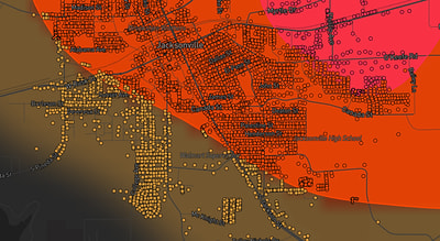
See exactly what you get.
Explore the full Springdale, AR Strike Map free – hail track, address overlay, and CSV download. No account required.
Try the Free Demo →