Oklahoma City, OK Hail Storm – November 2026
November 2, 2026 hail storm near Oklahoma City, OK. Radar-confirmed hail track and contractor lead lists available.
Max Hail
1.63"1.13" est.
confirmed
Zones
43
NWS alerts
Radar
463
dual-pol hits
Spotter
11
field reports
NWS WARNING AREA · Oklahoma City Metro · Nov 2, 2026
Intelligence Platform
StormSnipe Pro
$49/ mo
Cancel anytime · No contracts
›All 50 states
›No zone limits
›No per-event fees
Subscribe to Pro
Pro renews monthly until canceled · Cancel anytime in the billing portal
What's included
Instant delivery
Every storm published within hours of NOAA confirmation.
Interactive Strike Map
Full radar-confirmed hail track on an interactive map.
Address CSV export
Every affected residential address, export-ready.
Smart alerts
Notified when a storm hits your area. Set zones once.
Nationwide coverage
All 50 states. No zone restrictions. No geographic caps.
Live pipeline
NOAA NEXRAD processed and delivered 24/7.
Address data notice
Pro coverage in California, Vermont, and Oregon includes the confirmed hail track and Strike Map only — no address lists. State data-privacy law treats compiled address lists differently in those three states, so we exclude their addresses from extraction and delivery.
NWS WARNING AREAS · 43
This storm generated 43 NWS alert zones. Pro access covers the complete storm track and all addresses across every zone.
ZONE 1NWS OKC017
Oklahoma City, OK
Dual-Pol Radar
Alert issued Mon, Nov 2 · 6:54 PM UTC
1.5"
confirmed
1"
est. (NWS)
ZONE 2NWS OKC027
Oklahoma City, OK
Dual-Pol Radar
Alert issued Mon, Nov 2 · 7:29 PM UTC
1.25"
confirmed
1"
est. (NWS)
ZONE 3NWS OKC081
Agra, OK
Dual-Pol Radar
3 addresses in warning area
Alert issued Mon, Nov 2 · 8:05 PM UTC
0.75"
confirmed
1"
est. (NWS)
ZONE 4NWS OKC043
Seiling, OK
Dual-Pol Radar
Alert issued Mon, Nov 2 · 8:29 PM UTC
1.25"
confirmed
1"
est. (NWS)
ZONE 5NWS OKC011
Chester, OK
Dual-Pol Radar
Alert issued Mon, Nov 2 · 8:36 PM UTC
1.5"
confirmed
1"
est. (NWS)
ZONE 6NWS OKC009
Custer City, OK
Dual-Pol Radar
Alert issued Mon, Nov 2 · 9:12 PM UTC
2.25"
confirmed
1"
est. (NWS)
ZONE 7NWS OKC011
Fairview, OK
Dual-Pol Radar
Alert issued Mon, Nov 2 · 9:14 PM UTC
1.5"
confirmed
1"
est. (NWS)
ZONE 8NWS OKC003
Cleo Springs, OK
Dual-Pol Radar
Alert issued Mon, Nov 2 · 9:55 PM UTC
1"
confirmed
1"
est. (NWS)
ZONE 9NWS OKC011
Putnam, OK
Dual-Pol Radar
Alert issued Mon, Nov 2 · 9:59 PM UTC
1.5"
confirmed
1"
est. (NWS)
ZONE 10NWS OKC003
Nash, OK
Dual-Pol Radar
Alert issued Mon, Nov 2 · 10:42 PM UTC
1.25"
confirmed
1"
est. (NWS)
ZONE 11NWS OKC011
Okeene, OK
Dual-Pol Radar
Alert issued Mon, Nov 2 · 10:43 PM UTC
1.25"
confirmed
1"
est. (NWS)
ZONE 12NWS OKC039
Cordell, OK
Dual-Pol Radar
Alert issued Mon, Nov 2 · 10:49 PM UTC
1.75"
confirmed
0.75"
est. (NWS)
ZONE 13NWS OKC015
Mountain View, OK
Dual-Pol Radar
Alert issued Mon, Nov 2 · 11:27 PM UTC
1.5"
confirmed
0.75"
est. (NWS)
ZONE 14NWS OKC011
Hydro, OK
Dual-Pol Radar
19 addresses in warning area
Alert issued Mon, Nov 2 · 11:36 PM UTC
1.5"
confirmed
1"
est. (NWS)
ZONE 15NWS OKC031
Roosevelt, OK
Dual-Pol Radar
5 addresses in warning area
Alert issued Mon, Nov 2 · 11:52 PM UTC
2"
confirmed
1.13"
est. (NWS)
ZONE 16NWS OKC011
Calumet, OK
Dual-Pol Radar
Alert issued Tue, Nov 3 · 12:14 AM UTC
1.5"
confirmed
0.75"
est. (NWS)
ZONE 17NWS OKC015
Carnegie, OK
Dual-Pol Radar
Alert issued Tue, Nov 3 · 12:15 AM UTC
0.75"
confirmed
1"
est. (NWS)
ZONE 18NWS OKC047
Hunter, OK
Dual-Pol Radar
Alert issued Tue, Nov 3 · 12:19 AM UTC
0.5"
confirmed
0.75"
est. (NWS)
ZONE 19NWS KSC191
Wellington, KS
NWS Warning
Alert issued Tue, Nov 3 · 12:26 AM UTC
0.75"
est. (NWS)
ZONE 20NWS KSC173
Wichita, KS
NWS Warning
17 addresses in warning area
Alert issued Tue, Nov 3 · 12:35 AM UTC
0.75"
est. (NWS)
ZONE 21NWS OKC017
Okarche, OK
Spotter Reported
Alert issued Tue, Nov 3 · 12:42 AM UTC
1"
confirmed
0.75"
est. (NWS)
ZONE 22NWS OKC053
Blackwell, OK
NWS Warning
Alert issued Tue, Nov 3 · 12:51 AM UTC
0.75"
est. (NWS)
ZONE 23NWS OKC113
Ponca City, OK
NWS Warning
Alert issued Tue, Nov 3 · 1:51 AM UTC
0.75"
est. (NWS)
ZONE 24NWS OKC027
Elmore City, OK
NWS Warning
Alert issued Tue, Nov 3 · 2:20 AM UTC
1"
est. (NWS)
ZONE 25NWS OKC113
Shidler, OK
NWS Warning
Alert issued Tue, Nov 3 · 2:22 AM UTC
0.75"
est. (NWS)
ZONE 26NWS OKC019
Ardmore, OK
Dual-Pol Radar
64 addresses in warning area
Alert issued Tue, Nov 3 · 3:25 AM UTC
0.88"
confirmed
1"
est. (NWS)
ZONE 27NWS OKC049
Roff, OK
NWS Warning
Alert issued Tue, Nov 3 · 3:56 AM UTC
0.75"
est. (NWS)
ZONE 28NWS OKC019
Tishomingo, OK
NWS Warning
Alert issued Tue, Nov 3 · 3:59 AM UTC
0.75"
est. (NWS)
ZONE 29NWS OKC037
Boley, OK
NWS Warning
Alert issued Tue, Nov 3 · 4:24 AM UTC
0.75"
est. (NWS)
ZONE 30NWS OKC029
Allen, OK
NWS Warning
Alert issued Tue, Nov 3 · 4:31 AM UTC
0.75"
est. (NWS)
ZONE 31NWS OKC005
Coleman, OK
NWS Warning
Alert issued Tue, Nov 3 · 4:38 AM UTC
0.75"
est. (NWS)
ZONE 32NWS OKC005
Stringtown, OK
NWS Warning
Alert issued Tue, Nov 3 · 5:10 AM UTC
0.75"
est. (NWS)
ZONE 33NWS OKC035
Nowata, OK
NWS Warning
Alert issued Tue, Nov 3 · 5:23 AM UTC
0.75"
est. (NWS)
ZONE 34NWS OKC023
Stringtown, OK
NWS Warning
Alert issued Tue, Nov 3 · 5:36 AM UTC
0.75"
est. (NWS)
ZONE 35NWS OKC105
Lenapah, OK
NWS Warning
Alert issued Tue, Nov 3 · 5:43 AM UTC
0.75"
est. (NWS)
ZONE 36NWS OKC061
Clayton, OK
NWS Warning
Alert issued Tue, Nov 3 · 6:10 AM UTC
0.75"
est. (NWS)
ZONE 37NWS OKC035
Big Cabin, OK
NWS Warning
Alert issued Tue, Nov 3 · 7:10 AM UTC
0.75"
est. (NWS)
ZONE 38NWS OKC035
Vinita, OK
NWS Warning
Alert issued Tue, Nov 3 · 7:11 AM UTC
0.75"
est. (NWS)
ZONE 39NWS ARC131
Spiro, OK
NWS Warning
Alert issued Tue, Nov 3 · 7:20 AM UTC
0.75"
est. (NWS)
ZONE 40NWS ARC033
Chester, AR
NWS Warning
Alert issued Tue, Nov 3 · 8:09 AM UTC
0"
est. (NWS)
ZONE 41NWS OKC089
Bagwell, TX
NWS Warning
Alert issued Tue, Nov 3 · 8:11 AM UTC
0"
est. (NWS)
ZONE 42NWS ARC143
Natural Dam, AR
NWS Warning
Alert issued Tue, Nov 3 · 8:23 AM UTC
0"
est. (NWS)
ZONE 43NWS ARC133
Eagletown, OK
NWS Warning
Alert issued Tue, Nov 3 · 8:59 AM UTC
0"
est. (NWS)
A hail-producing storm tracked through the Oklahoma City metro on November 2, 2026, producing a peak stone of 1.63 inches and prompting 43 NWS alerts and multiple radar detections. Spotters and dual-polarization radar logged repeated 1.00–1.25-inch observations across the metro from mid-afternoon into the evening.
What Happened
The storm initiated in mid-morning and intensified in the early afternoon over central Oklahoma, producing the first NWS warning at 12:54 PM CST that referenced hail to 1.00 inch. Dual-polarization radar detected 1.00-inch hail at 1:29 PM CST, and spotters reported multiple quarter-sized observations between 1:11 PM CST and 1:32 PM CST. Two mPING entries at 1:30 PM CST recorded half-dollar-sized hail at discrete locations in the metro.
The line maintained pulse activity through the late afternoon. Radar again returned hail detections near 3:12 PM CST and 3:59 PM CST. A radar-derived 1.13-inch detection occurred at 5:52 PM CST as the system moved west-to-northwest across the metro. Multiple NWS warning-only alerts followed through the evening and overnight, with the last advisory at 2:59 AM CST on November 3.
Field reports show repeated smaller clusters of quarter-sized and nickel-sized hail later in the night. A spotter-verified nickel-sized observation, roughly 0.88 inch, was reported near Jehovah Road and Oil City Road at 9:20 PM CST. Some radar returns in the late evening trended down to 0.75 inch before the line weakened.
Damage Assessment
Local storm reports and mPING entries for this event recorded hail-size observations without accompanying NWS damage reports in the LSRs. Two 1.25-inch half-dollar reports at 1:30 PM CST and several quarter-sized entries in the early afternoon indicate concentrated surface impact in central and nearby neighborhoods during the storm's peak. The 0.88-inch report near Jehovah Road and Oil City Road at 9:20 PM CST documents a separate late-evening cell that produced smaller but measurable stones.
Radar-derived detections at 1.13 inch late in the afternoon show pockets of stronger hail intensity that were not widely duplicated in the spotter stream. Reported sizes cluster into two periods: an early-afternoon pulse with multiple quarter- to half-dollar observations, and a late-evening pulse with mostly nickel- to quarter-sized reports. Field reports did not include roof-collapse or large-structure damage entries in the LSRs for this event.
Contractors working claims should map inspections to reported observation points rather than to the broader NWS warning area. Focus initial walk-throughs where spotters logged 1.25-inch and 1.00-inch observations in the early afternoon and at the Jehovah Road and Oil City Road location for the 0.88-inch late-evening report.
What Contractors Should Know
Start with photographic documentation and a clear chain of custody for evidence. Photograph vehicle panels, gutters, AC units, and roofing from fixed positions with timestamps and GPS where available. For locations tied to the 1.25-inch and 1.00-inch spotter entries, prioritize hail-ding surveys on horizontal surfaces and metal flashings. These sizes can cause dents and cracked sealant on siding and metal components; record material type and pre-existing condition for each observation.
Storm Details
- Start Date
- Monday, November 2, 2026
- Last Activity
- Tuesday, November 3, 2026
- Location
- Oklahoma City, OK
- Warning Areas
- 43
- Dual-Pol Radar
- 463
- Spotter Reports
- 11
Preview Strike Map
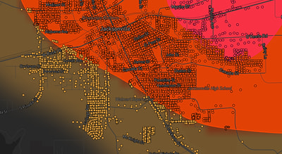
See exactly what you get.
Explore the full Springdale, AR Strike Map free – hail track, address overlay, and CSV download. No account required.
Try the Free Demo →